Select your domain
Modern day society relies heavily on all sorts of infrastructure ranging from energy and data networks to (rail) roads and harbors. Keeping this critical infrastructure safe and functioning in both a reliable and sustainable way is a challenging undertaking. Infrastructure owners are faced with challenges like: how to monitor hundreds to thousands of kilometers of infrastructure in a reliable and cost-effective way? How to detect threats in an early stage, both in crowded and/or completely desolated areas? How to prioritize and deploy inspection there where it matters most? How to make monitoring independent from weather conditions? Our solutions provide an answer to all these questions!
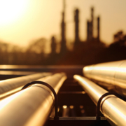
Oil/Gas Pipeline Monitoring
Third party interferences form a large potential risk for damage to oil- and gas pipelines. In addition, these pipelines are often distributed through large geographical areas.
Using satellite data, we can monitor your entire oil- and gas pipelines, and detect potential threats. With the help of an advanced dashboard, these potential threats can be assessed, to check whether interventions are necessary.
Using our services provides a reliable, safe and sustainable method for monitoring your assets.
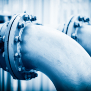
Water pipeline monitoring
Water pipelines are essential to everyday life. In these times of increasing water scarcity, leakages are a cause for concern. It is therefore of vital importance to be able to prevent leakages or to fix them as soon as possible.
Using satellite data, we offer a solution that can monitor threats to your water pipelines, such as excavation and heavy traffic, enabling you to take action when required. Moreover, our solution provides the opportunity to trace back the cause of a leakage, resulting in quick, targeted fixes of the pipeline, rather than replacing a large piece of pipeline due to assumed degradation.

Deformation monitoring
Surface deformation can cause significant damage to assets and operations. This deformation can be the result of for example soil composition, construction works or natural resource extraction.
Using satellite data, we can efficiently monitor and analyze surface deformation, enabling you to gain valuable information about potential threats to your assets or operations.

Earth Moving
Earth moving activities need to be monitored to assess whether they are harmful to assets or operations. In addition, monitoring is needed to ensure contaminated soils are dealt with in the proper manner.
Using satellite data, we can automatically monitor large areas to detect earth moving activities. With the help of an advanced dashboard, these activities can be assessed to check whether the activity is legal or whether the activity requires further inspection. Using this dashboard, inspections can focus on only those cases that matter.

Maritime Monitoring
The problem of rising challenges in the maritime security sector provides the need for cost effective means to increase situational awareness on sea and around the coastal lines. We can deliver this increase in situational awareness by using smart integration of several data sources into a platform that facilitates (automatic) anomaly detection.
Furthermore, three distinct modes of operating ensure that the cost of acquiring additional information about an anomaly corresponds with the threat level. This is one of the unique selling points of our cost-effective solution.
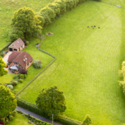
Site Monitoring
Environmental and law enforcement agencies are faced with the challenge of investigating a multitude of possible infractions with a limited work force. It is therefore vital that they have access to all relevant information. Remote sensing can speed up inspection by automatically monitoring sites of interest.
Our site monitoring solution combines Remote Sensing data with advanced analytics and integrates those into an advanced dashboard. This maximises the situational awareness for inspection and enforcement operators.
Protecting the environment from unwanted effects of human activities is becoming increasingly important in modern day society and lies at the foundation of Orbital Eye. Gaining insight in harmful activities being executed, or into the effects caused by these activities, is often challenging. Our solutions address these challenges by combining and integrating multiple data sources and contextual information to detect suspicious and/or possible harmful activities or to provide insight into the effects generated by these activities. Our solutions are tailored to be integrated into current practices, in order to maximize companies’ and individual’s ability to safeguard the environment and contribute to further raise awareness wherever possible!

Air quality
Given the current trends in increasing urbanization and larger need for sustainability, companies, citizens and policy makers have a need for accurate, high resolution air quality data.
We offer a platform that collects air quality data from multiple sources, such as satellite data, atmospheric models, local measurements, weather forecasts and land use. This data is analyzed using an advanced air quality forecast and scaling model. This results in actual and accurate air quality descriptions at high resolution, from the past, of the present and for the future.

Forest monitoring
Changes in forests can occur due to multiple reasons, such as storms, pests, fires or clear cutting. Moreover, the species of a tree can influence the course of such an event. The only way to get insight into these events is by routine monitoring.
Using satellite data, we offer a solution that can regularly inspect your forests, and automatically detect changes, keeping you up to date on the status of the forest. We can determine the specie of a tree by using aerial imagery. Besides, we use historical data to analyze past events, to give insight into why these events have happened.
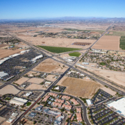
Landuse
Dependent on the land use, a range of threats can cause harm to your assets. Determining the land use around your assets increases the effectiveness of monitoring your assets and helps in taking the right decisions for intervention.
Our solution uses satellite data, deep learning models and intelligent algorithms to classify land by use. Data about land use can be integrated into your current monitoring solutions.
About Orbital Eye
Orbital Eye was founded in 2012 in Delft, The Netherlands by remote sensing and machine learning enthusiasts. Orbital Eye leverages its unique capabilities to provide earth observation based services to keep assets, infrastructure and the environment safe, using both radar and optical satellite imagery. Orbital Eye can detect, analyse and report changes in your area of interest.
About S&T
Orbital Eye is a member of the S[&]T group. S[&]T creates R&D solutions for Space, Science and Defense. S[&]Ters in our offices in the Netherlands and Norway are hard at work, sensing problems and developing solutions. They specialise in Sensing and Control Systems, Scientific Data Processing, Intelligent Software Applications and Technical R&D Consultancy.
Latest News
 Celebrating our 12-year anniversary with a team trip to the ArdennesJune 27, 2024 - 2:27 pm
 Orbital Eye visited Trinidad and Tobago to meet with customers, partners, and other pipeline operatorsJune 13, 2024 - 2:33 pm
 Full version of PTC conference paper 2024May 17, 2024 - 11:05 am
 Wrapping up PTC BerlinApril 12, 2024 - 2:44 pm


