Orbital Eye is growing!


This week, Arnaud van den Berg has signed his contract with the director of Orbital Eye, Erik Zoutman, to start as a business developer at Orbital Eye. Arnaud has a Bachelor’s degree in International Business Administration from the Radboud University Nijmegen, and a Master’s degree Business Information Management from the Erasmus University Rotterdam. In his free time, you can find Arnaud cycling or traveling, preferably to sunny places. We believe that his passion for international business, technology and innovation can help us in making sure that more and more companies will keep their assets safe using our Earth Observation Based technology!

Welcome Arnaud!


Orbital Eye at E-world Energy & Water


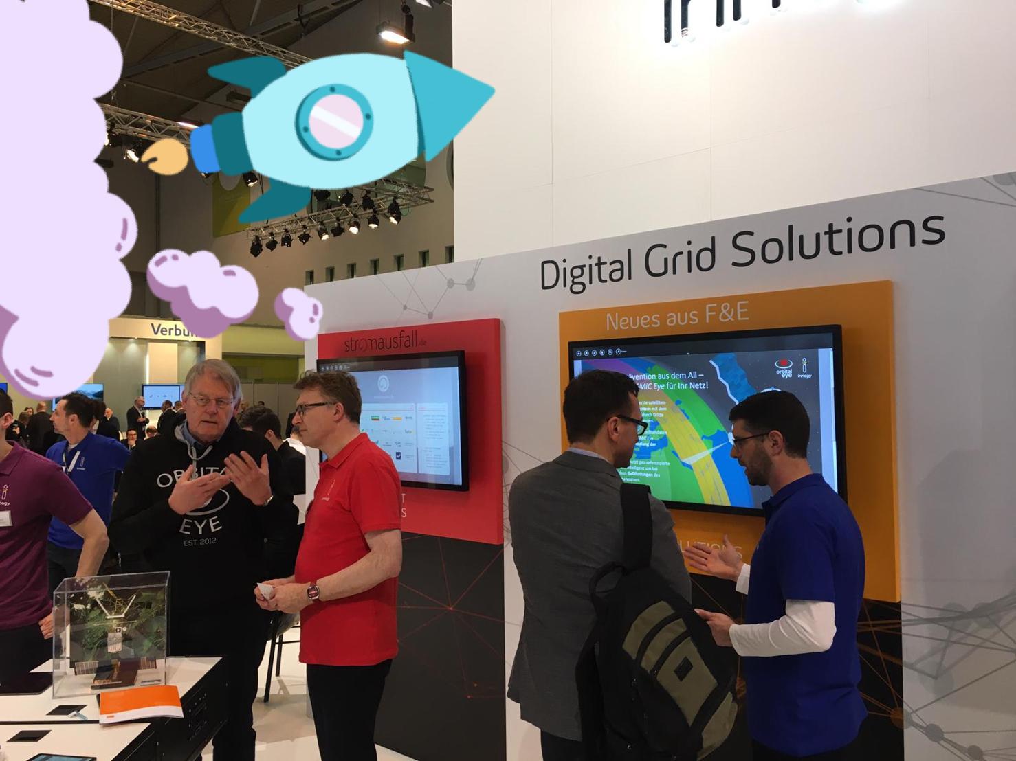
Happen to visit the E-world energy & water exhibition in Essen the coming days? Then don’t miss out on this great opportunity to meet the Orbital Eye team and hear the latest on our space technology based asset monitoring solution #CoSMiC-EYE, the state-of-the-art in third-party-interference monitoring for energy grids!

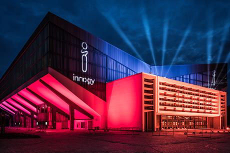
Drop by for a demo or any questions at Halle 3, Booth 100 where we are hosted by our development partner Innogy SE .

Orbital Eye makes it to next phase of MarineEO project

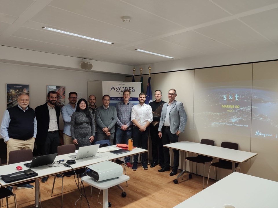
MARINE-EO is a commercial Horizon 2020 project in which S[&]T, Orbital Eye B.V., and Sonaca competed against two other consortia in developing services for helping coast guards and other maritime authorities increase their situational awareness by pointing out potential security anomalies around oceanic and coastal areas. (read more: https://marine-eo.eu )
The Maritime Scene Investigation (MSI) prototype is built around Orbital Eye’s radar-based change-detection system and uses a fusion of satellite and ship-positioning data to detect and classify potentially anomalous ship behaviour or coastal infractions.

Marine-EO PCP Project is ready for the final phase of a project that will deliver tailored solutions for public authorities and security agencies in #EU.

Safeguarding from Space

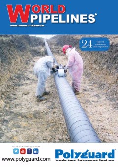
Orbital Eye featured on pages 77-79 of World Pipelines magazine – Palladian Publications Ltd Business World Pipelines Magazine (Volume 19, Number 8, August 2019).
Marco Betting, Orbital Eye, the Netherlands, explains how satellite-based monitoring can be utilised in the protection of assets.

Orbital Eye B.V. and innogy SE join forces.

DELFT, The Netherlands Oct. 2, 2018 – Orbital Eye B.V., a member of the S[&]T group, announced today that it has signed a co-operation agreement with the German based energy company innogy SE.
Orbital Eye and innogy will work together in the development and exploitation of a Satellite based Monitoring method informing Network Operators about dangerous activities near their gas pipelines or power cables. With this co-operation a first step is made towards a fully automated and digitized Right-of-Way monitoring method for the Energy Distribution sector. This innovative solution will help the sector to reduce tens of millions per year of damage caused by outage and repair work, caused by unsupervised excavation activities, while increasing the external safety of their networks.

Orbital Eye at the Dutch National Pipeline Platform Event

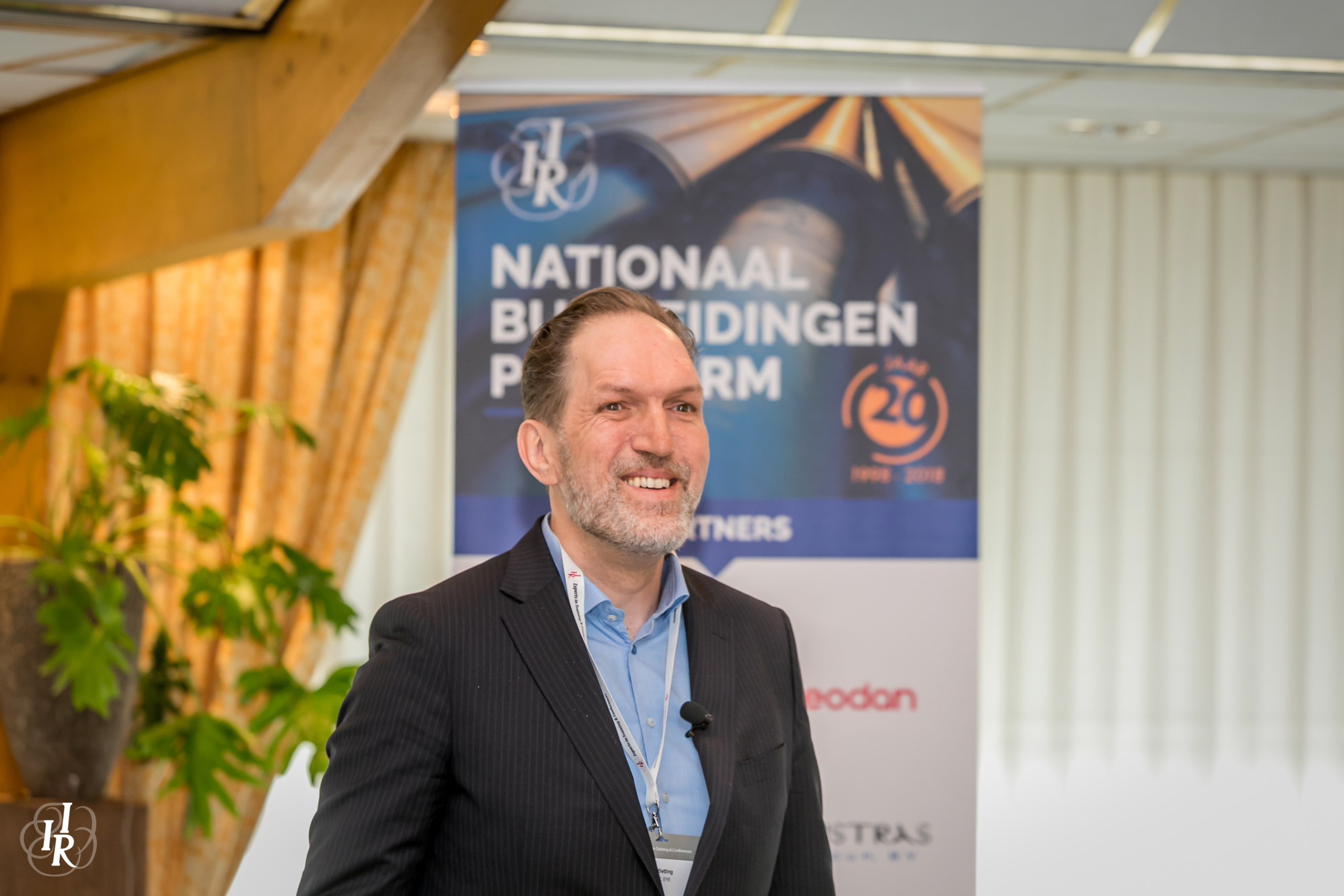
On the 21st of March of 2018 the CEO of Orbital Eye, Marco Betting, addressed the Dutch pipeline community with an inspiring talk on “Remote Sensing technology for pipeline route safety” during the Dutch National Pipeline Platform Event (Nationaal Buisleidingen Platform) organised by IIR Netherlands.
Missed this opportunity to learn how remote sensing technology can help you to keep your critical infrastructure safe in a reliable and sustainable manner? Please contact us at info@orbitaleye.nl.

Sentinels bring solutions to pipeline monitoring

How can pipeline operators monitor hundreds to thousands of kilometres of pipeline in a fast and cost-effective way?

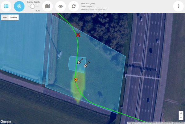
Pipeline works following a PIMSyS detection alert
Today pipeline operators are faced with numerous challenges, from detecting threats at an early stage, whether in crowded or deserted areas, to prioritising inspection activities in a sensible and sustainable manner, to monitoring pipelines regardless of the weather.

Using the free and open data from the Copernicus Sentinel-1 constellation, the Dutch high-tech service company Orbital Eye B.V. delivers advanced monitoring solutions to network operators.
Remote sensing is a powerful tool that allows large, remote, inaccessible areas to be examined.
Satellites, such as the Sentinels of the European Copernicus programme are excellent for detecting change. Images from these satellites greatly improve the viability of commercial operations. The revisit frequency – directly determining the monitoring frequency for periodic surveillance purposes – can be as high as once every three days.
The Synthetic Aperture Radar (SAR) on Sentinel-1 covers Earth’s landmass entirely regardless of the weather or daylight.
Orbital Eye created a pipeline monitoring tool – PIMSyS (Pipeline Integrity Management System from Space) – that offers solutions for monitoring critical infrastructure such as transmission pipelines, powerlines, roads and railways. Developed as Orbital Eye’s core product, PIMSyS shows pipeline operators exactly where and when potential hazards occur. It combines accurate and up-to-date monitoring data with smart tools to visualise relevant context data such as planned third-party activities, and support inspection work processes and planning.
PIMSyS
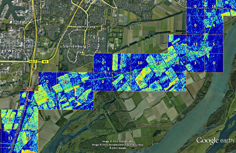
Using SAR Coherent Change Detection technology (SAR-CCD), change maps are generated by comparing two radar images of the same geographic region, taken at different times. This highlights areas where a significant change has occurred between the two image dates. For highlighted areas with a high probability of a Third Party Interference (TPI) and overlapping the pipeline corridor, a warning is generated by PIMSyS in the form of a GIS object (see orange balloon marker).
The SAR data provided by Sentinel-1 satellites enable reliable and sustainable periodic monitoring of large geographical areas. Being weather independent, they provide a high degree of spatial and temporal availability.
Marco Betting, Managing Director of Orbital Eye, says, “With both Sentinel-1 satellites in orbit since end of 2016, Orbital Eye is increasing the monitoring frequency for European Pipeline Operators up to 10 times a month. This will hugely increase the probability of detection of short-lived third party activities in the corridors of their networks”.
While Sentinel-1 radar data are best used for the detection of anomalies in the extremely large areas of pipeline corridors, multispectral satellite images – for instance those of Sentinel-2 – can be used to further zoom-in on any anomalies that have been detected with the radar. This better classifies the detected changes.
“Although Orbital Eye’s monitoring technology already applies advanced filters for removing non-hazardous events in agricultural and harbour areas, developments will further increase the selectivity of our monitoring technology by fusing optical data with our radar detections in order to minimise ‘false alarms’ and maximise the situational awareness of pipeline operators,” concluded Mr Betting.
About the Sentinels
The Sentinels are a fleet of dedicated EU-owned satellites, designed to deliver the wealth of data and imagery that are central to Europe’s Copernicus environmental programme.
In partnership with EU Member States, the European Commission leads and coordinates this programme, to improve the management of the environment, safeguarding lives every day. ESA is in charge of the space component, responsible for developing the family of Copernicus Sentinel satellites and ensuring the flow of data for the Copernicus services, while the operations of the Sentinels have been entrusted to ESA and EUMETSAT.

The Eye in the Sky

Orbital Eye featured on pages 20-22 of World Pipelines magazine – Palladian Publications Ltd Business World Pipelines Magazine (December 2016)
Pipeline operators are responsible for the safe transport of hazardous materials through transmission pipelines. Since pipeline failures can cause severe damage to people, infrastructure and the natural and built environment, operators are concerned with monitoring the integrity of their pipelines on a regular or even continuous basis. This article discusses the use of radar satellite imagery to provide pipeline operators with a continuous source of information in order to monitor and manage their assets from space.
The December issue of World Pipelines includes several articles that introduce and consider pipeline integrity and sensing, rehabilitation and retrofit, and much more.

Pijpleidingen controleren vanuit de ruimte

In Nederland ligt 12.000 km aan gas- en olieleidingen; het is geen eenvoudige zaak om de conditie ervan in de gaten te houden.

‘De meest gangbare inspectiemethode is een periodieke controle per helikopter’, vertelt Erik Zoutman, oprichter van Orbital Eye. ‘Dat is een tamelijk dure methode, die bovendien milieubelastend is en veel geluidsoverlast veroorzaakt. Wij denken door satellietgegevens te gebruiken een aantrekkelijk alternatief te hebben.’ Zoutman werkte na zijn studie elektrotechniek aan de UT eerst een tijd bij de ruimtevaartafdeling van TNO in Delft.
Vervolgens richtte hij in 2000 het in Delft gevestigde S [&] T op, een bedrijf dat onder meer software ontwikkelt voor de ruimtevaart­instrumentatie. Zoutman: ‘We hebben op een gegeven moment een project gedaan, waarbij we keken of we satellietradargegevens konden gebruiken voor het inspecteren van pijpleidingen.’ Uit dat succesvolle project rolde startup Orbital Eye, dat een softwarepakket heeft ontwikkeld waarmee het sinds 2015 op de markt is. De benodigde gegevens komen van ESA-aardobservatiesatellieten; twee tot drie uur nadat deze boven een specifiek gebied hebben gevlogen, is de gewenste informatie beschikbaar en komt automatisch bij de klant terecht.

Grote groeimarkt

‘De radar kijkt niet naar de pijpleiding, maar naar wat er in de omgeving gebeurt’, aldus Zoutman. ‘Corrosie is bijvoorbeeld met radar niet op te merken. Maar als de corrosie lekkage tot gevolg heeft, zie je dat meteen aan de vegetatie in de directe omgeving.’
Zoutman verwacht een grote groeimarkt, vooral in het buitenland: ‘Eigenlijk durf ik te stellen dat iedereen die nu nog inspecteert met een helikopter, over zal stappen op gebruik van satellietgegevens, omdat het goedkoper, veiliger en nauwkeuriger is. Op dit moment heeft Orbital Eye geen concurrenten, maar omdat wij succesvol zijn, zal er ongetwijfeld op korte termijn een concurrerend bedrijf opdoemen. Maar de markt is groot. We hebben net champagne gedronken, omdat we in het buitenland weer een grote klant hebben binnengehaald. We mogen de naam van het bedrijf niet noemen. Maar we hebben de komende tijd weer veel werk.’

Monitoring pipelines from space

Dutch company Orbital Eye has developed a service that uses satellites to monitor gas and oil pipelines. A major African pipeline operator has already signed up for the service.
Worldwide, gas and oil pipelines extend two million km. In most cases, this network is not very deep: just 1.5 m below our feet.
Gas pipes in the EU alone stretch 140 000 km, another 40 000 km carry oil and related products. In addition, there are the final distribution lines to our homes and places of work.
For pipeline operators, safety is paramount. Accidents tend to be serious enough to endanger people and the environment, as well as to damage the pipeline itself.
In Europe, almost half of all failures in high-pressure gas transmission pipelines are caused by excavations, construction work and deep ploughing.
Operators reduce such incidents through aerial surveys from helicopters along the entire pipeline route at least every three weeks.
However, 37% of problems are detected by the public, while aerial inspection surveys pick up only 17%. Orbital Eye’s PIMSyS service can improve this detection rate.
The system uses radar images from satellites in combination with smart software to detect potential threats as well as the slightest ground movement.
PIMSyS tablet app
PIMSyS tablet app

Pipeline operators, alerted to suspicious events, then dispatch field personnel to find reported or detected hazards using a tablet app.
The app can connect to the central database via terrestrial networks and satcoms and can therefore be used even in remote locations such as desert areas.
The EU’s Copernicus programme, with its growing constellation of Sentinel satellites, offers free high-quality observation data, day or night, independent of weather conditions.
“We have been using Sentinel-1A imagery since the satellite was launched, and the results have been very positive,” noted Jan Ridder, Managing Director at Orbital Eye.
“Currently, Sentinel-1A data are refreshed on average once every 12 days. Initially, some operators prefer a higher frequency, but once they start using the system they find that the current rate is adequate in many cases.”
Sentinel-1B, launched on 25 April, is expected to provide more regular visits and over larger regions, including Asia, Africa and the USA, allowing Orbital Eye to expand its service.
“Thanks to ESA’s support, we were able to deploy PIMSyS for two operators in 2015, gaining real-world experience. This was critical for gaining the trust of new customers in this industry.”
ESA’s Olivier Becu commented: “Our Integrated Applications Promotions programme gives promising start-ups such as Orbital Eye the opportunity to develop and deploy new space-based services in an operational setting in order to prove their products together with users.”